
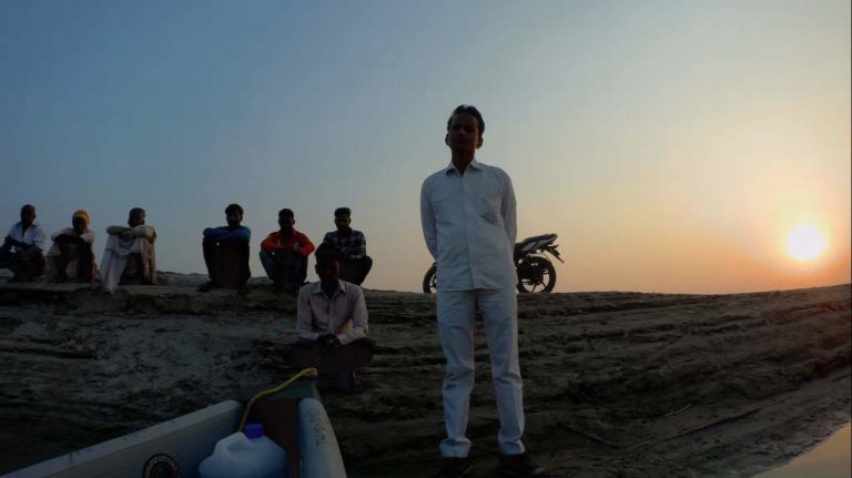
Testing the Ganges waters
Slow Boat Down the Ganges Update 34
A SLOW BOAT DOWN THE GANGES is about raising awareness about pollution in the river.
I have been trying to associate with an organisation that manufactures portable water testing equipment. In vain. I have had no success. Moreover, since I am no scientist, I was looking for an instrument that would test the waters on the fly without any kind of intervention from me. The instrument had to do its thing, store the data, for someone to interpret it at the end of the expedition.
There is one organisation that makes some pretty fancy stuff, but the instrument is expensive and they did not have an extra demo unit they could spare for the duration if this expedition. The expedition was launched without any way of testing the waters.
But that changed due to the fact that I had to break the expedition due to the wrist injury. I was feeling frustrated that I was not being able to collect any data, of any kind, and that was not such a good thing. Finally, I decided on a couple of units that together would provide me with test results of the water temperature, total dissolved solids, electrical conductivity and pH. I wanted to break down the kinds of dissolved solids so that a more informed interpretation could made about the quality of the water.
 Nevertheless, now I at least have something. The two instruments will arrive in the next couple of days. I plan to test the waters periodically, maybe every hour or so. I will have to have a cup collect the sample water that I plan to test, record the data collected, and save it on a spreadsheet on Google Drive. The internet is present everywhere and the need to physically write down the results in a notebook can be made easier by typing and saving on the internet. Hey, I can even share the results of the data collected in real time, for anyone to see as the data is collected, as soon as it is uploaded. Nice.
Me happy.
Like I said, I am no scientist and I needed to learn just a few basic things about what I would be testing. The infinite world of the worldwide web opened up and I walked right into its library to find out a bit more.
First, Total Dissolved Solids or TDS.
TDS represents the total concentration of dissolved substances in water and is made up of inorganic salts like calcium, magnesium, potassium and sodium (positively charged cations) and carbonates, nitrates, bicarbonates, chlorides and sulfates (negatively charged anions), and a small amount of organic matter.
A high level of TDS is not necessarily a hazard, since the body requires many of the natural minerals, some of which are added to bottled water. Some mineral waters are expensive because of the high concentration of natural and healthy minerals. The unhealthy TDS minerals are a result of things like agricultural runoff, urban runoff, household and industrial waste water, etc. A high level of TDS also makes the water hard, leaving scaly deposits, as well as being flat to the taste.
However, a high level of TDS is also an indicator of the possibility of minerals such as iron, manganese, sulfate, bromide, arsenic, etc being present in the water. With a high TDS result, it makes sense to carry out further tests to find the actual composition of the dissolved solids.
According to the World Health Organisation, the preferable level of TDS in water is indicated as:
| Mg/litre | Rating |
| Less than 300 | Excellent |
| 300 - 600 | Good |
| 600 - 900 | Fair |
| 900 - 1,200 | Poor |
| Above 1,200 | Unacceptable |
These are guidelines and not mandatory standards, since the water source in different regions might have different levels of naturally occurring dissolved solids.
The pH level measures the acidity or alkalinity of water.
pH values range from 0 to 14, with 7 being neutral. The lower the value, the more acidic the water, the higher the value, the more alkaline. The best water is neutral with a pH value of 7. Generally, a pH level between 6.0 to 8.5 is safe. Pollution, particular industrial, chemical, decomposing vegetation, vehicles fumes, etc lead to water becoming contaminated with harmful acids. This affect not only humans, but also aquatic life. The closer the pH level is to 7.0, the better.
When there are harmful dissolved solids and the pH is acidic, the combined effect is potentially far more harmful.
A high TDS and a low pH are both red flags, indicating harmful contaminants and deserve further analysis.
The Ganges is a sacred river, one of the great rivers of the world, and unfortunately, one of the most polluted. Much of the pollution is due to human factors and the possible incapability of the river to rejuvenate. We are polluting the river faster than she can recharge herself.
There are two main sources of water pollution - point and non-point sources.
Point sources include factories, wastewater treatment facilities, sewage, etc. Non-point sources are sediment, fertilizer, chemicals and animal wastes from farms, fields, construction sites, mines, unburnt corpses, religious offerings, etc. India is one huge land fill and contaminants can and do leach into the water.
Heat can also lead to pollution.
With a high water temperature, the amount of dissolved oxygen decreases. Aquatic plants and animals require a certain kind of environment to thrive in, like temperature and dissolved oxygen. Warmer waters reduces aquatic diversity.
By the way, I will be measuring the water temperature too.
The instruments I have purchased are not expensive and I do not know how accurate their results will be. However, from whatever I have seen on the magic room of the internet, these are the kinds of instruments being used by individuals for household use. Even if they are not 100% accurate, it will at least provide some indication of the current status.
I suspect that as I go downstream, the graph will start doing the disco, with increasing pollution. With a reading every hour or so, which should translate to about every five odd kilometres, this should provide some comprehensive data for anyone in the field. I will certainly make this data available publicly for anyone to access it and use it. After all, this expedition is all about finding answers on how to clean the holy river.
I have missed out on gathering the data for the first 300 odd kilometres, but there was not much pollution I witnessed in any case. However, had the data been there, the graph might have become even more dramatic. Nevertheless, better late than never. I will have water data from Kachla Ghat onward, hopefully all the way to the Bay of Bengal. Fingers crossed.
The results of the tests I carry out can be viewed here.
 (5 votes, average: 5.00 out of 5)
![]() Loading...
Loading...


Nice to follow you.
When do you recommence.
Thank you for following. I am back on the water from Monday (29/10) morning, from Kachla Ghat. Two days paddle to Farrukhabad. Trying to see if I can connect with the TA Bn there. Grateful if you can help.
A good Scientific addition to the Expedition. Well done. ?????
Yes Alex, I really wanted to test the waters. People test it at specific cities and/or points. I have the opportunity of gathering much more data across a wider geography. If it helps someone, good.